
Micael Runnström & Maria Andrea Nardi
Nature is a key concept in our ongoing research, but we need to define it if we want to evaluate possible drivers of environmental conflict within the peace process. If nature is defined as green resources, for instance, it is possible to assess how vulnerable peace might be, against environmental changes occurring on the ground by using satellite data. Satellite data can then be used, in combination with fieldwork and interviews, to monitor and map changes in green environments in a post-conflict period.
As satellite data can be classified into land cover categories (e.g., forested area), it is possible to compare two land cover classifications representing different stages in time, and map changes that have occurred on the ground. To map changes in a whole country at high detailed resolution is however a tedious and difficult task that requires good understanding about the landscape, field ground truth, and also knowledge in how to prepare and process satellite data.
An alternative way is to use a calibrated and prepared satellite data time series of a product, e.g. a vegetation index (VI). A VI is constructed by measuring the difference in reflected solar energy between different parts of the electromagnetic spectrum, especially focusing on the red wavelength band (~0.65 µm) and the near infrared band (~0.75 – ~1.5 µm). A time-series dataset of VI can then be used to calculate trends through time.
One VI widely used is the Normalised Difference Vegetation Index (NDVI) which is an indicator of vegetation greenness of biomes. The NDVI is providing a physical status of leaf area index (LAI), fraction of vegetation cover, and fraction of absorbed radiation for the photosynthesis. These parameters provide a possibility to assess density, production and health of the vegetation (see here).
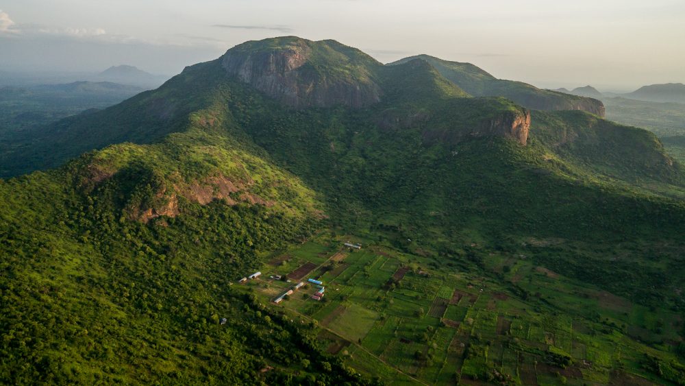
To monitor environmental changes in northern Uganda during and after the armed conflict around 2008, a time series of MODIS (Moderate Resolution Imaging Spectroradiometer satellite sensor) NDVI data at 1000*1000m pixel resolution between 2002 and 2018 was used to evaluate changes in vegetation properties. The annual phenology was analysed to discover the vegetation cycle inferred by NDVI values and rainfall pattern of Uganda.
In Uganda there are two main rainy seasons (March – May and September – November). NDVI images, acquired in June-July each year, provides an annual footprint of the vegetation peak that can be used to calculate the linear trend of the vegetation activity through the time series in each 1 km2 pixel.
By calculating the linear trend direction for two different periods it is possible to evaluate how vegetation have developed during the armed conflict period (2002 – 2008) (figure 1), compared to the post-conflict period (2008 – 2018) (figure 2). A negative trend of NDVI indicates that vegetation activity was declining (negative equation – red colours) and a positive trend indicates that the photosynthetic activity, and thus vegetation LAI or density was increasing (green colours). Yellow colours indicate that the trend line equation is close to zero meaning that vegetation activity was stable throughout the period.
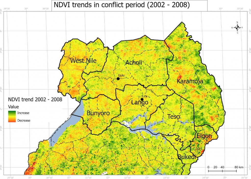
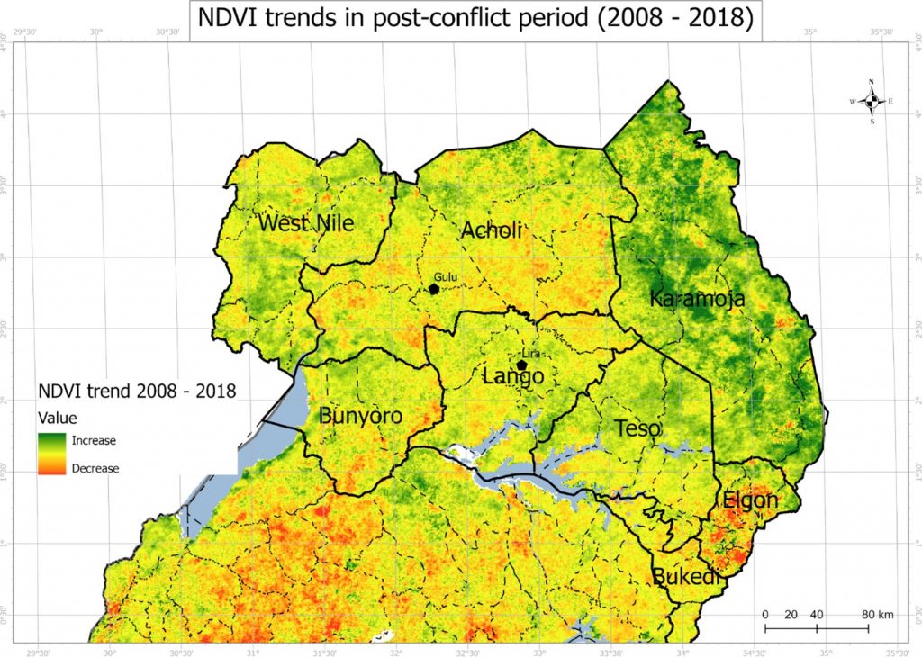
NDVI trends can now be further analysed to derive statistics for different administrative regions and land use systems (e.g. national parks, forest reserves), in order to evaluate gain or loss of vegetation activity, inferred by NDVI.
We will expand on this in the coming post! Thanks for your comments and sharing our preliminary work, supported by the Swedish Research Council for Sustainable Development (FORMAS – Grant 2018-00453).